AI Map to Street View Generator
Transform aerial map views into realistic street-level perspectives using AI. Convert map arrows, pins, and directions into ground-level views instantly.
🗺️ Convert any map view to street-level perspective in seconds
Drag and drop images here, or click to select
Max 5 files, 10MB each
See Map Transformation in Action
Watch how AI converts aerial map views into realistic street-level perspectives
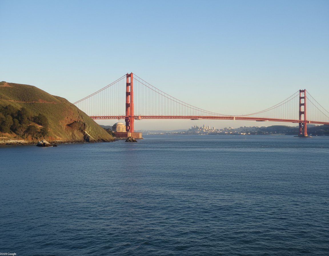
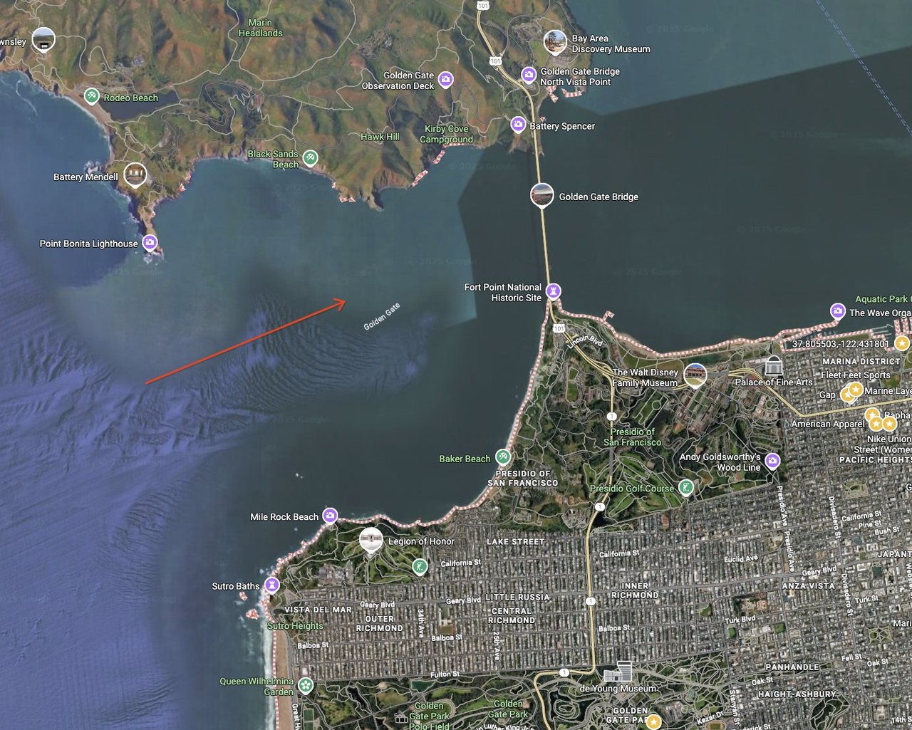
Map to Street View AI Converter
Upload a map with arrow or pin, get AI-generated ground-level view perfect for visualization and planning
How to Convert Map to Street View
Transform aerial perspectives to ground level in 3 simple steps with AI-powered visualization
Why Choose AI Map to Street View
Advanced AI technology for converting aerial map perspectives to realistic ground-level street views
Location Recognition
AI automatically detects map arrows, pins, and markers to identify the exact viewing perspective needed
Realistic Generation
Creates photorealistic street-level views with proper lighting, depth, and environmental details
Multiple Angles
Generate different viewing angles and perspectives from the same map location for comprehensive visualization
High Resolution
Produces high-quality street view images suitable for presentations, planning, and professional use
Geographic Accuracy
Maintains geographic accuracy and realistic proportions based on actual map data and location features
Instant Results
Fast processing delivers street view results in seconds without need for specialized mapping software
Map to Street View FAQ
Common questions about AI-powered map to street view conversion
What types of maps can I convert?
You can convert any map screenshot including Google Maps, Apple Maps, satellite views, street maps, or hand-drawn maps with directional indicators like arrows or pins.
How accurate are the generated street views?
The AI creates realistic street-level perspectives based on typical urban environments and map features. While not identical to actual locations, they provide excellent visualization for planning and presentation purposes.
Can I specify the viewing direction?
Yes! Use arrows, pins, or directional markers in your map image. The AI will interpret these indicators to generate the appropriate street-level perspective and viewing angle.
What map formats work best?
Clear, high-resolution map images work best. Include directional arrows, pins, or markers. Both satellite and traditional street map views produce good results with proper indicators.
Is this useful for urban planning?
Absolutely! Urban planners, architects, and real estate professionals use this tool to visualize how locations appear from ground level, helping with site planning and presentations.
Can I create virtual tours?
Yes, you can generate multiple street views from different map locations and angles to create virtual tour experiences or location previews for websites and presentations.
How long does conversion take?
Most map to street view conversions are completed within 15-30 seconds. Complex maps with multiple features may take up to 3 minute for optimal quality results.
Can I use this for commercial projects?
Yes! The generated street views can be used for commercial presentations, real estate marketing, urban planning proposals, and other professional applications without restrictions.